The largest dam removal project in California at time of removal
General Info
The Removal
Sediment Buildup

Reservoir Capacity
The Timeline
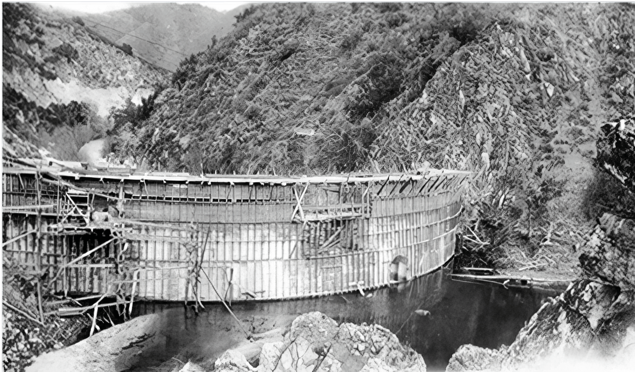
1912
San Clemente Dam was constructed on the Carmel River to provide water supply for the Monterey Peninsula. It was 106 feet tall and had a reservoir storage capacity of approximately 1,425 acre-feet.Once constructed, the reservoir quickly filled with sediment. Toward the end of its life, the reservoir was filled by more than 2.5 million cubic yards of sediment, leaving a storage capacity of only 70 acre-feet, or 5% of what it was built for. The dam no longer served a useful purpose.
1991
Dam declared seismically unsafe by state inspectors from California Department of Water Resources Division of Safety of Dams

1997
NOAA Fisheries first designates the South Central Coast Steelhead as a threatened species and then again in 2006
1999
Carmel River listed as one of North America’s 10 most endangered rivers (American Rivers)
2005
NOAA Fisheries designates the Carmel River as critical habitat for South Central Coast Steelhead
2006
Environmental studies prepared offering several alternatives for bringing the dam into compliance with safety standards (including removing it, buttressing it, and cutting it down partway)
2007
Additional studies confirm feasibility of dam removal option
2009
Dam removal and river re-route option chosen
The Problem
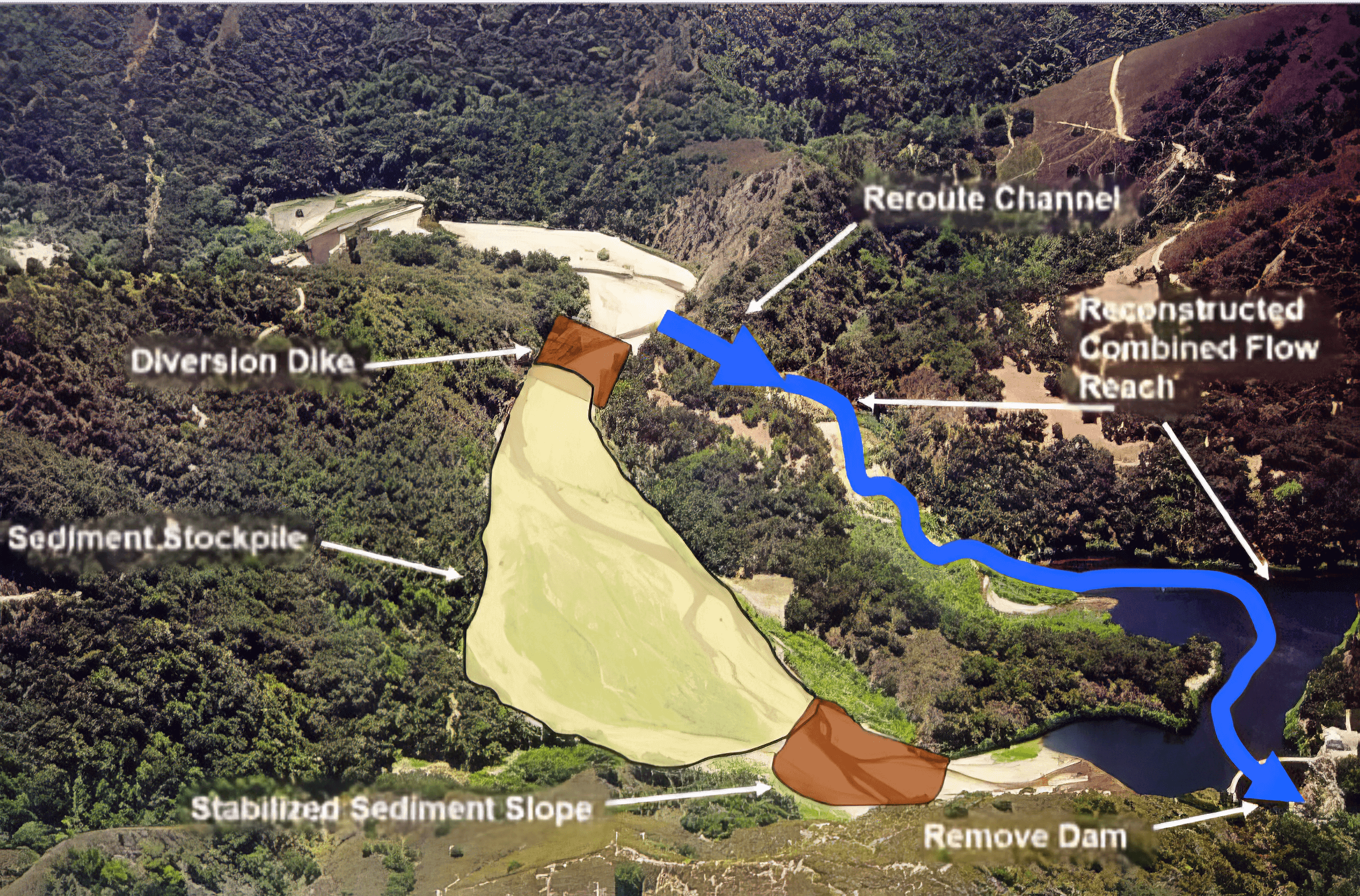
The Plan
1. Plugging sediment trapped behind the dam in place (as removing it was infeasible)
2. Re-routing the river to connect with the adjacent San Clemente Creek, and finally...
3. Removing the dam
2011
Preliminary designs completed and project approval received from California Public Utilities Commission
2015
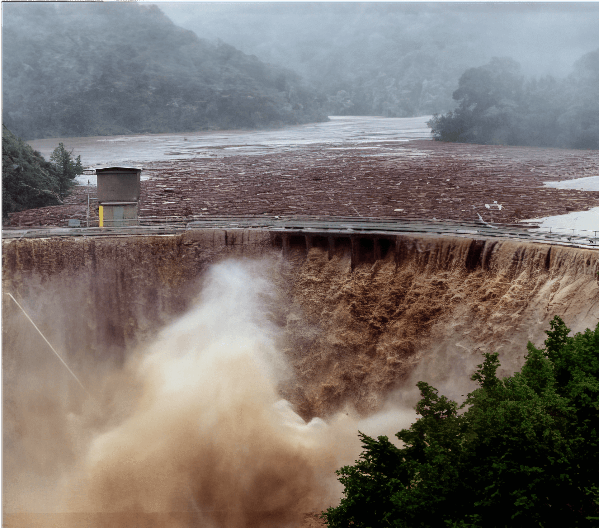
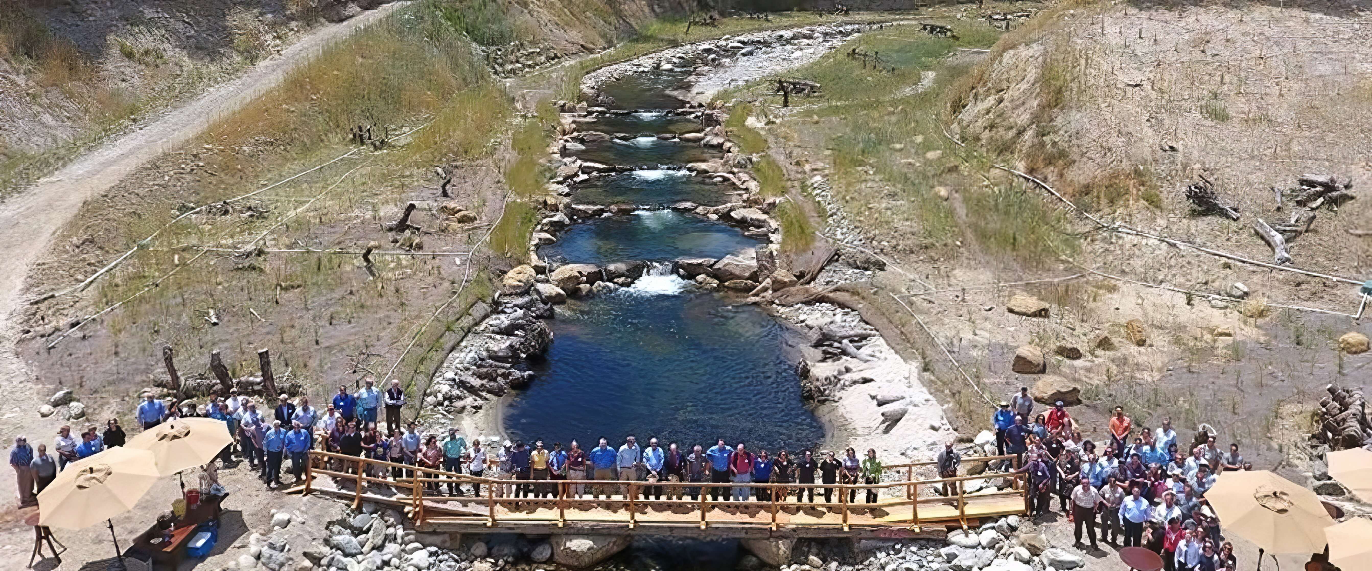
The dam was finally removed and the Carmel River was restored.
2016
Old Carmel River Dam removed

2017
Large flood reorganizes river channel
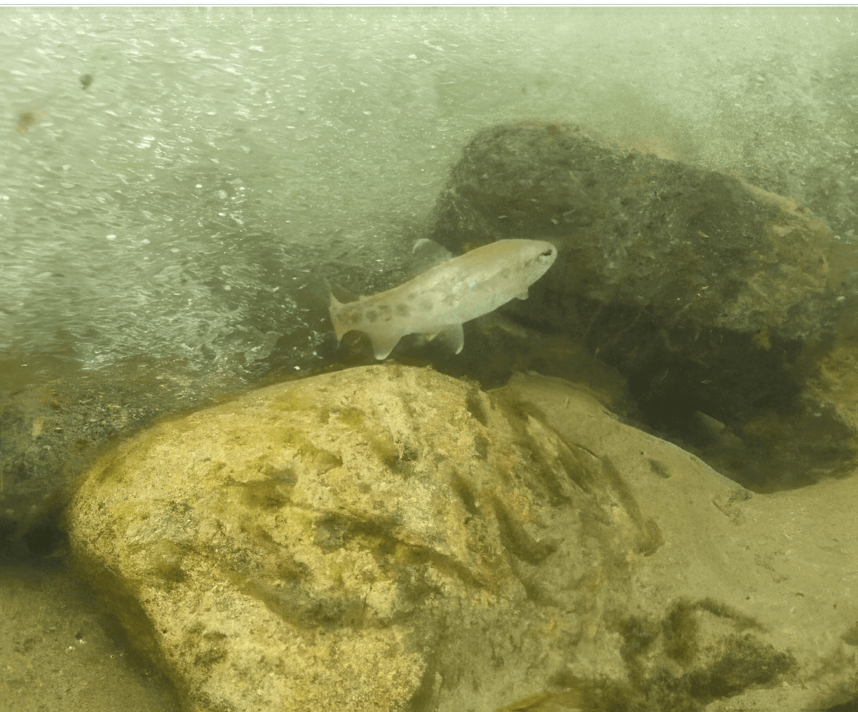
2019
127 steelhead counted at Los Padres Dam, five miles upstream
A River Re-Wilding
Now the Carmel River is free-flowing and the transformation of the Carmel River will continue as the river “re-wilds” itself.
Public Access Planning
Removing the San Clemente Dam and restoring the river was the first phase of this groundbreaking project. The next phase is to enable the public to access and experience the beautiful re-wilded Carmel River at this site, sharing the story of its transformation.
California American Water intends to transfer approximately 920 acres of the site to the U.S. Bureau of Land Management, which would be managed by Monterey Peninsula Regional Park District (MPRPD) for public access and connect MPRPD’s Garland Regional Park and San Clemente Open Space.
Because of the site’s remote location, access will be a back-country experience requiring a significant hike, bike, or horseback ride. Once reached, the site holds numerous opportunities:
- Public recreation along 3 miles of the Carmel River with potential for adding 5 miles more.
- Sharing the dam removal’s story of hope and transformation and the ongoing evolution of the river as it recovers.
- Potential to link together Garland Ranch Regional Park and San Clemente Open Space.
- Future potential to connect trails to nearby campsites in Los Padres National Forest’s Ventana Wilderness.
.jpg)
Next Steps
A community planning process is needed to evaluate access options, address community desires and concerns, and develop short- and long-term solutions. Contact the Coastal Conservancy (Trish Chapman, trish.chapman@scc.ca.gov) to stay informed of the next steps of the planning process.